The Maritimes have been on an extended run of very fair weather the last two weeks while under a persistent ridge of high pressure.
Unfortunately, that pattern changes this weekend with the approach of a weather front from the west and a likely post-tropical storm Philippe from the south.
The combination of weather systems is set to bring conditions that would be expected from a fall storm on Sunday.
Philippe as a tropical storm to the east of the U.S. Virgin Islands.
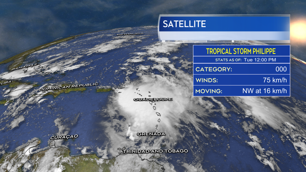
PHILLIPE
Tropical Storm Philippe currently sits about 130 km to the east of St. Thomas in the U.S. Virgin Islands. The maximum sustained winds near the centre of the storm are estimated to be near 75 km/h. Phillipe is moving to the northwest at 16 km/h.
The official forecast track from the U.S. National Hurricane Center brings Philippe north into the vicinity of Bermuda as a tropical storm on Friday. Philippe is then forecast to come into the Maritimes as a post-tropical storm on Sunday. Philippe is likely to be tied up into a weather front moving in from the west, bringing the Maritimes fall storm conditions on Sunday.
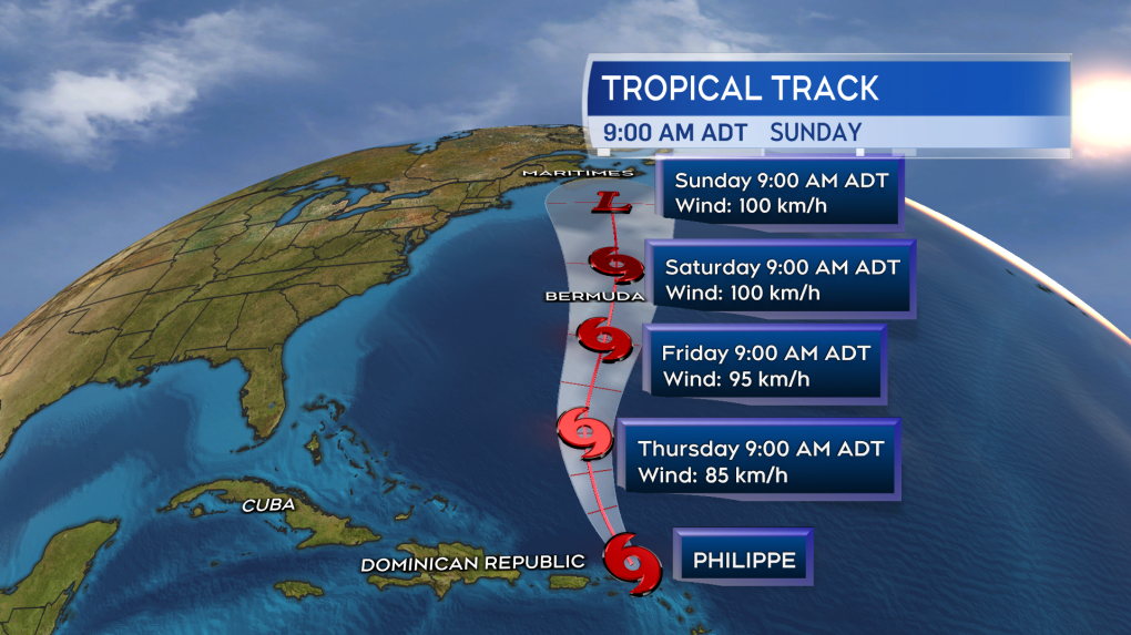 The official forecast cone for Philippe from the National Hurricane Center updated as of noon Monday, Oct. 3, 2023.
OUTLOOK
Philippe is not a Fiona or Dorian. It isn’t in the ballpark of the strength of those storms. I’d rate the storm as an 80 per cent chance of remaining tropical storm in strength and a 20 per cent chance of briefly reaching Category 1 hurricane strength as it moves north. It looks very likely it will complete a transition to a post-tropical storm before/if arriving in the Maritimes. You can think of that as the storm becoming similar to a Nor’easter, minus the snow.
It could still bring varied but impactful weather to the Maritimes on Sunday. It has at least a risk of producing some areas of rain totalling 50 mm or more. It also has a risk of producing some areas of wind gusts reaching 90 km/h or higher. The storm is still in the extended forecast and it is too early to start narrowing down areas likely to receive the heaviest rain or experience the strongest wind.
It is also too early to properly assess potential wave action brought into the Maritimes. Preliminary, it looks like less than what was seen with Lee, which would reduce the impact of coastal wash and erosion. It is also not a Full or New Moon this weekend, which means we are not at the peak of our tide cycle.
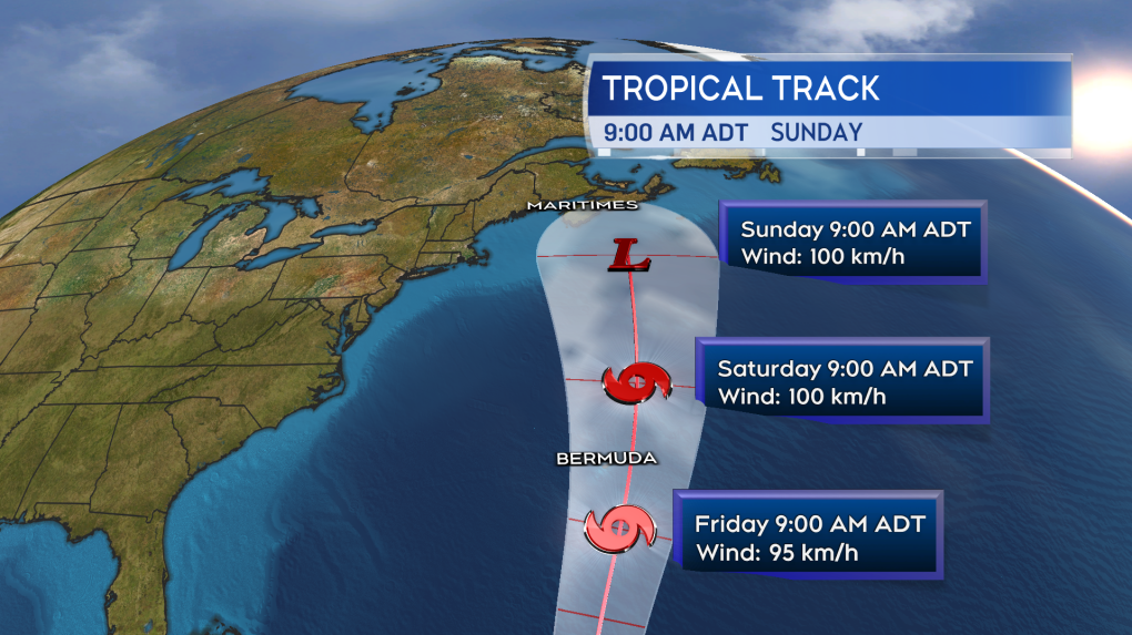 A closer look at the forecast cone as Philippe approaches the Maritimes. The “L” designating an expected transition of the storm to post-tropical.
In summary, Philippe needs to be watched as a contribution to a period of stormy weather this weekend — that looks most likely to be Sunday at this time. While likely post-tropical on arrival, rain and wind conditions could reach impactful levels for parts of the Maritimes.
I’ll have updates through the week on our CTV News Atlantic programming and at ctvnewsatlantic.ca.
Denial of responsibility! My Droll is an automatic aggregator of Global media. In each content, the hyperlink to the primary source is specified. All trademarks belong to their rightful owners, and all materials to their authors. For any complaint, please reach us at – [email protected]. We will take necessary action within 24 hours.
