A recent study published in Big Earth Data has shown how scientists from the Aerospace Information Research Institute (AIR) of the Chinese Academy of Sciences (CAS) harnessed satellite altimetry to track changes in the water level of 988 Chinese lakes larger than 10 square kilometers.
The study covered a period from 2002 to 2023 and utilized datasets from several altimeters including ICESat/-2, Cryosat-2, Jason-1/2/3, and Sentinel-3A/3B. Techniques applied in the study encompassed waveform retracking, lake level extraction, time series construction, multi-altimeter data fusion, and outlier removal.
The findings highlighted the significant function of satellite altimetry in compensating for the scarcity and inconsistency of conventional lake level measurements. Given the limitations in time and space coverage, satellite altimetry emerges as a vital alternative for assessing water balance, deciphering water cycles, and managing water resources amidst climatic and environmental changes.
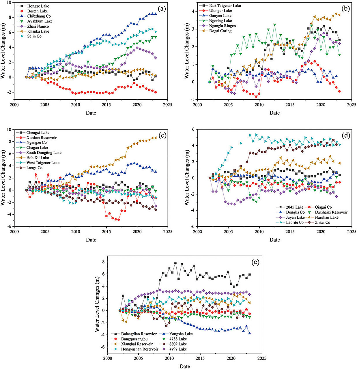
This expansive dataset, which includes over a decade of monitoring for 55% of the studied lakes and offers more than 12 annual measurements for 34% of them, contributes to the examination of long-term lake dynamics. Validation against in situ data from 21 lakes confirmed the precision of the satellite measurements, with root mean square errors ranging from 0.163 m to 0.596 m for individual altimeter datasets, and 0.332 m for the fused lake level.
Observations throughout the period indicated a prevalent rise in water levels in Chinese lakes, showing an overall annual average rate of change of 0.123 m/a over 20 years and 0.151 m/a over 10 years. The trend was particularly evident in larger lakes, which experienced noteworthy increases, while smaller lakes tended to have a more rapid decline. The Tibetan Plateau region was distinguished by the most significant rise in water storage, exhibiting an average annual water level change rate that exceeded 0.15 m/a during the last two decades.
This precise spatiotemporal dataset represents a gateway to new possibilities in estimating lake water storage alterations, analyzing trends in lake levels, comprehending plateau flooding dynamics, and examining the intricate relationship between lake ecosystems and their water resources. It is anticipated that the findings of this study will enhance our comprehension of the complex interactions shaping China’s varied lake environments.
More information:
Shanmu Ma et al, A dataset of lake level changes in China between 2002 and 2023 using multi-altimeter data, Big Earth Data (2024). DOI: 10.1080/20964471.2023.2295632
Citation:
Satellite altimetry reveals significant changes in water levels of Chinese lakes over two decades (2024, January 12)
retrieved 13 January 2024
from https://phys.org/news/2024-01-satellite-altimetry-reveals-significant-chinese.html
This document is subject to copyright. Apart from any fair dealing for the purpose of private study or research, no
part may be reproduced without the written permission. The content is provided for information purposes only.
